European Turkey and Greece 1
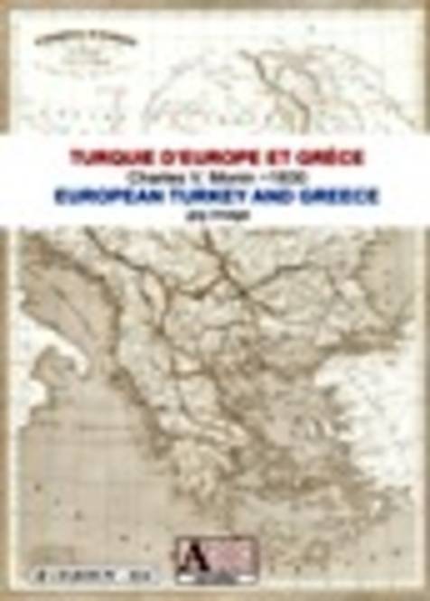
European Turkey - MoninAn antique map of Southern Balkan about 1830, shorlty after Greek independence.1 scanned map of the Balkan peninsula.Size of 4795 x 6724 pixels x 360 dpi.Real size, same as the original: 33, 83 cm x 47.44 cm.Can be viewed ...
Last update
23 Jul. 2010
Licence
Free to try |
$8.34
OS Support
Windows
Downloads
Total: 297 | Last week: 0
Ranking
#223 in
E-book Software
Publisher
Screenshots of European Turkey and Greece
European Turkey and Greece Publisher's Description
European Turkey - Monin
An antique map of Southern Balkan about 1830, shorlty after Greek independence.
You will receive, after payment, a download link valid for 24 hours with login and password.
Physical shipping
You will receive, in addition, a CD-ROM copy of the European Turkey and Greece map. Physical shipping costs are 10 euros for all countries.
- 1 scanned map of the Balkan peninsula.
- Size of 4795 x 6724 pixels x 360 dpi.
- Real size, same as the original: 33, 83 cm x 47.44 cm.
- Can be viewed and printed with any imaging software (Photoshop, Photopaint, Irfanview, Gimps etc.)
- Original map in French.
- Discrete watermark.
You will receive, after payment, a download link valid for 24 hours with login and password.
Physical shipping
You will receive, in addition, a CD-ROM copy of the European Turkey and Greece map. Physical shipping costs are 10 euros for all countries.
Look for Similar Items by Category
Feedback
- If you need help or have a question, contact us
- Would you like to update this product info?
- Is there any feedback you would like to provide? Click here
Popular Downloads
-
 KaraFun Karaoke Player
2.6.2.0
KaraFun Karaoke Player
2.6.2.0
-
 Kundli
4.5
Kundli
4.5
-
 Macromedia Flash 8
8.0
Macromedia Flash 8
8.0
- FastSum 1.9
-
 FastSum Standard Edition
1.6
FastSum Standard Edition
1.6
-
 Cool Edit Pro
2.1.3097.0
Cool Edit Pro
2.1.3097.0
-
 Cheat Engine
6.8.1
Cheat Engine
6.8.1
-
 Hill Climb Racing
1.0
Hill Climb Racing
1.0
-
 GeoGebra
5.0.44
GeoGebra
5.0.44
-
 My Talking Tom
1.0
My Talking Tom
1.0
-
 Tom VPN
2.2.8
Tom VPN
2.2.8
-
 Windows XP Service Pack 3
Build...
Windows XP Service Pack 3
Build...
-
 C-Free
5.0
C-Free
5.0
-
 Facebook Messenger
440.9.118.0
Facebook Messenger
440.9.118.0
-
 Vector on PC
1.0
Vector on PC
1.0
-
 Vidnoz AI
1.0.0
Vidnoz AI
1.0.0
-
 Netcut
2.1.4
Netcut
2.1.4
- Jingle Keyboard 2.4
- Video Guardian XP 3.0
-
 Auto-Tune Evo VST
6.0.9.2
Auto-Tune Evo VST
6.0.9.2